Folkestone to Dover Walk
The Folkestone to Dover Walk is one of the most dramatic coastal walks in Kent, offering towering white cliffs, vast Channel views and layers of military and maritime history. Following a spectacular section of the King Charles III England Coast Path, this linear route connects two historic port towns via some of the most iconic scenery in England.
Starting at Folkestone Harbour, the walk travels east along cliff tops and downland before finishing in Dover, long known as the Gateway to England.

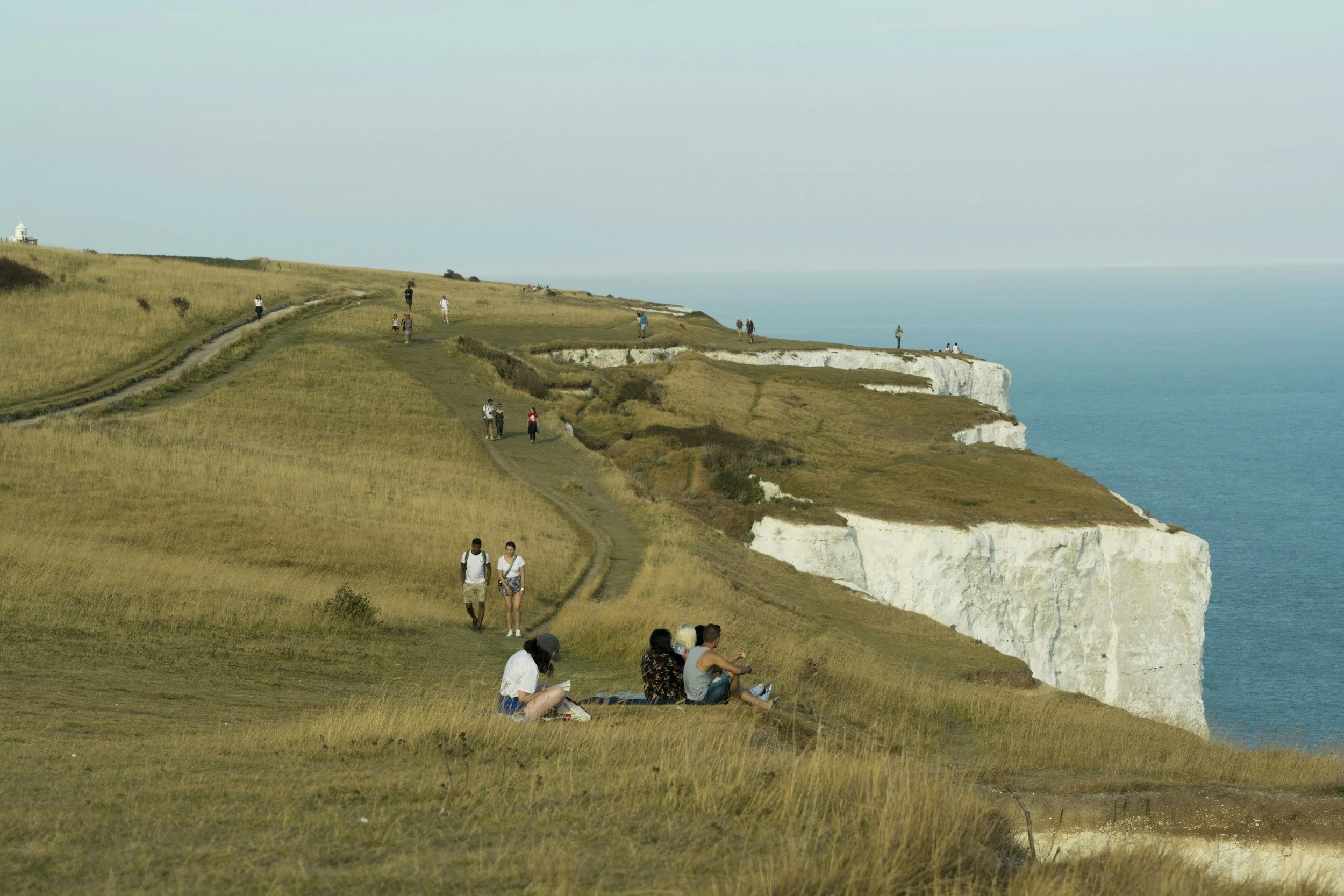
The scenic White Cliffs of Dover
Route at a Glance
Distance: approx. 9 miles (14.4 km)
Time: 4.5-5.5 hours
Difficulty: Moderate
Route type: Linear
Terrain: Clifftop paths, grassland, chalk tracks, steps
Gates: 11
Steps: 11 sections
Area: Kent Coast
Finish station: Dover Priory
OS Explorer map: 138
OS Landranger map: 189
Walk Highlights
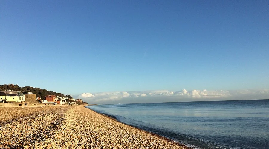
Folkestone Harbour and Sunny Sands beach
East Cliff and Warren Country Park wildlife reserve
Sweeping clifftop views across the English Channel
Battle of Britain Memorial at Capel-le-Ferne
Samphire Hoe, created from Channel Tunnel spoil
Shakespeare Cliff and the approach into Dover
Route Description
Folkestone Harbour to East Cliff
Begin at the lively Folkestone Harbour Arm, a restored railway platform now filled with cafés and sea views. From here, pass Sunny Sands, a classic sheltered cove, and look out for public artworks that form part of the Folkestone Artworks trail.
Continue along the beach before climbing towards the cliffs, where the first Martello towers appear - reminders of Kent’s long defensive history.
East Cliff and Warren Country Park
After passing Martello Tower No. 3, follow the signed path into East Cliff and Warren Country Park. This nationally important landscape supports rare wildlife, dramatic geology and open grassland, making it one of the most ecologically valuable coastal sites in Britain.
Pause often here - the views back towards Folkestone and across the Channel are exceptional.
Capel-le-Ferne and the Battle of Britain Memorial
The route continues along exposed clifftops past Capel-le-Ferne, reaching the striking Battle of Britain Memorial. Dedicated to “The Few”, this moving site includes an aircraft museum, wall of remembrance, café and visitor facilities.
This section offers some of the finest coastal views in England, especially on clear days when France feels close enough to touch.
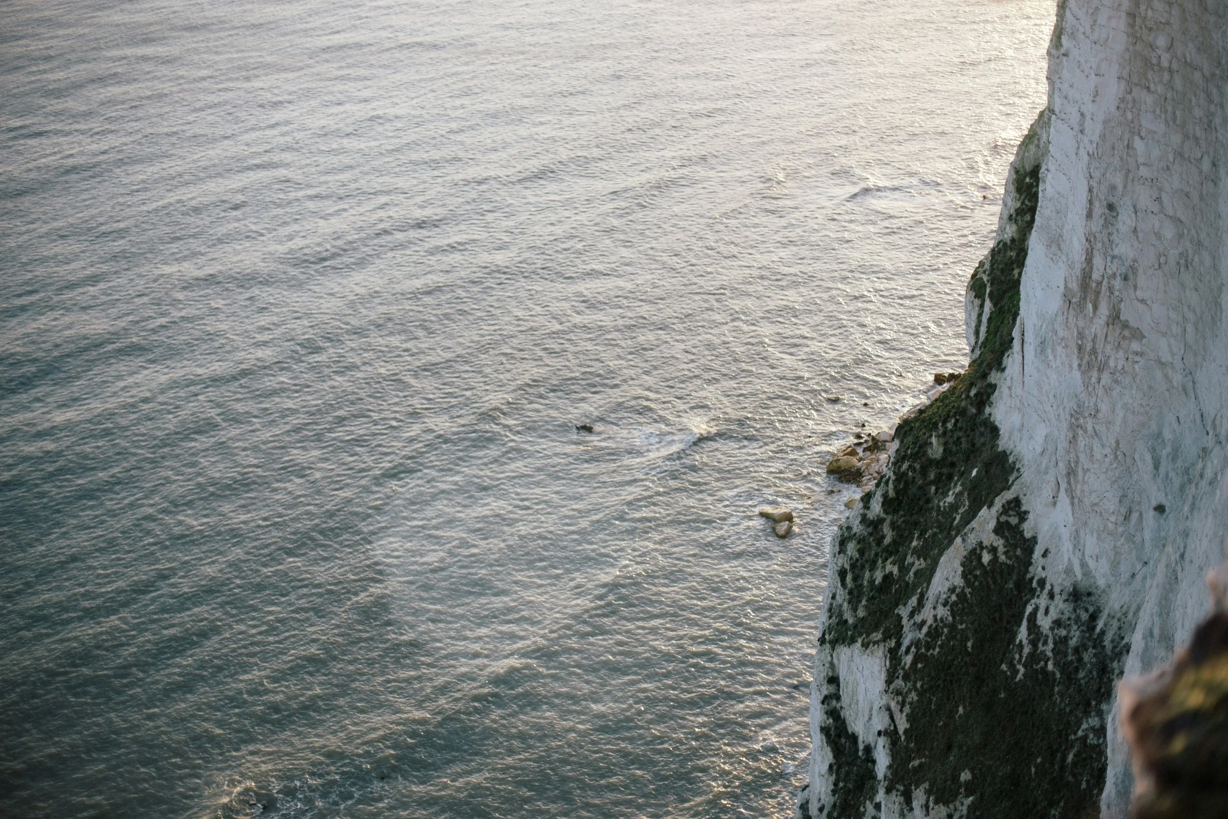
Abbots Cliff and Samphire Hoe
Beyond Capel-le-Ferne, the path traverses Abbots Cliff, where the coastline curves dramatically towards Dover. Look out for the Abbots Cliff sound mirror, an early 20th-century acoustic warning system that predates radar.
Below the cliffs lies Samphire Hoe Country Park, a remarkable landscape formed from chalk excavated during construction of the Channel Tunnel. Remnants of wartime defences, including the Hougham Battery, are visible along the way.
Shakespeare Cliff and Arrival into Dover
Climbing again, the path crosses Shakespeare Cliff, said to have inspired a passage in King Lear. The walk then passes through the vast fortifications of Western Heights of Dover, including the imposing Drop Redoubt, often described as Dover’s “upside-down castle”.
Descending into the town, views open up across Dover Castle on the Eastern Heights. Finish in the town centre, where Dover Museum and the Bronze Age Boat Exhibition are well worth a visit.
Practical Tips
Exposure: This is an open clifftop walk - wind can be strong
Footwear: Sturdy walking shoes recommended
Facilities: Cafés and toilets at Folkestone Harbour, Battle of Britain Memorial and Dover
Return travel: Dover Priory offers fast rail links back along the coast